Emergency Management – 2025
2025 Wildfire Evacuation Exercise
Overview
For a second year, I partnered with LPCOEM on its week-long wildfire simulation and training event. Where 2024 centered on coordination across 32 agencies, 2025 shifted to community awareness and preparedness, driven by the early-2025 Palisades-area fires.

The Exercise
Phase One: Public Outreach
A two-week, county-wide campaign launched in April: local media, podcast interviews with the USFS and BLM, social media, print collateral, and in-person town halls.
Phase Two: Emergency Communication & Resources
- Live test of FEMA's iPAWS and CodeRED alerts to residents' phones
- Staffed call center and launch of ReadyLaPlata.org, a resource hub with real-time evacuation information
- Preparedness Workshop and Expo at the La Plata County Fairgrounds with fire officials, WWPF, OEM staff, and regional agencies, featuring workshops on:
- Healthcare Facilities Emergency Preparedness
- Access and Functional Needs (AFN) Planning
- Large and Small Animal Evacuation Readiness
Phase Three: Simulated Fire Scenarios
Two neighborhood simulations: the Meadows Fire in Edgemont Meadows and the Rockwood Fire in North Animas Valley (Glacier Club, Cascade Creek, Purgatory). Each featured escalating fire paths, iPAWS evacuation alerts reaching 70,000+ phones, live Search & Rescue with Rapid Tags, Department of Homeland Security check-ins, and post-incident damage assessment in Crisis Track.


What I Designed
Hyper-realistic before-and-after damage simulations
Images of specific residential properties, selected to support LPCOEM's fire progression scenarios. Crisis Track assessors used the before/after images to practice post-fire damage evaluations under realistic conditions.
Process
- Used OpenAI's ChatGPT image gen for rapid, iterative development of photorealistic damage tailored to each residential structure
- Applied art direction and compositing to depict structural loss, burn-throughs, ash, smoke damage and debris under consistent environmental lighting
- Integrated final image sets into the Meadows Fire and Rockwood Fire scenarios
Impact
- The striking final imagery grounded the exercise in emotional realism and strengthened the FEMA-style documentation training, damage assessment, and community response workflows
- Following strong response in both 2024 and 2025, the client requested the full before-and-after collections as presentation decks for inter-agency briefings and public outreach


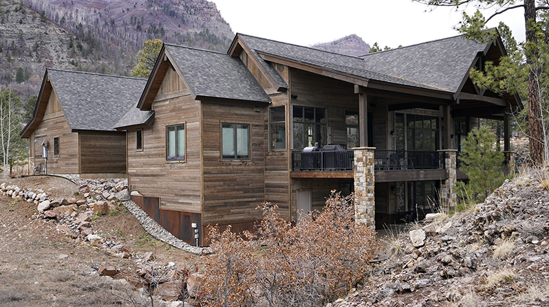
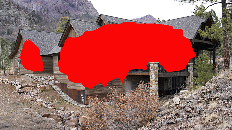


Example of an assessor capturing simulated damaged residence imagery on site, as if it was real-world damage.
All the before-and-after simulated images were created for this key purpose, offering assessors ‘as real as it gets’ imagery, reflective of what they’ll be witnessing in real life.
